Sunday, September 23, 2012

Return to Ariège Pt. 1 - Cars and Trees

After spending some time last week working on the maps themselves, I realized that I needed a bit more  context from the landscape itself - the fog and clouds that had plagued our field work had since lifted and it was the perfect opportunity to return and see some of the high mountain landcover that had been obscured the week before...

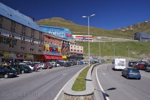
A friend of mine happened to be visiting from Switzerland, so we decided to rent a car and drive up into the mountains on Saturday.

My Pyrénéen GoKart

Renting a car in Europe was an easy exchange - much easier than in the US - however there was some initial skepticism on the part of my friend as to whether I was actually able to drive stick... There is a common misconception in Europe that Americans are somehow unable to manage this - I guess they learn something new every day... 

I must admit that during the drive up for the field work, I was pretty jealous that I didn't get to drive on the windy mountain roads...

Most of the roads are so narrow that passing another car involves some backing up and tricking maneuvering. The words of my Uncle Bill echoed in my head - "Dude, who cares - beat up on it, it's a rental

Still, I navigated the turns with the utmost care - the thought of rolling down a steep mountain hill in a car smaller than your average gokart seemed to dampen my adolescent hormones. The French, however, did not - it seems the National Sport is testing Newton's Laws of Gravity in some of their highest and most inhospitable mountains. 

But enough about driving -


The target of the trip was to try and get a better understanding of how vegetation (trees in particular), are beginning to colonize and reforest the upper elevations of the study area. It's one of the bigger themes of the mapping project, perhaps because it is one of the more striking changes that is taking place in the region.

As the livestock that had been roaming and eating everything in sight begin to vanish, the seedlings of trees that had once been food are now being left to grow.

Having seen this phenomenon in the lower portion of the valley near Vicdessos and Auzat, I moved up in elevation to the valley of Artigue-


View Larger Map
Zoom in and check it out!

A mountain slope showing pine trees beginning to march upwards

It was an absolutely beautiful time of day - the low light of the afternoon sun really helped differentiate the types of trees that grow in the area. The interface between forested and cleared land remains somewhat cut and dry, although you can clearly see some brave young trees breaking out from the protection of their brethren. 

After taking some pictures from reference, I decided to return to the Soulcem valley to try and see the tops of the mountains that had been obscured the week before. 

As there is still a very active pastoral culture in the area, travel on the roads is often left to the whims of the animals that graze here, and, well, wherever else they damn well please!

Taking a nap

Grazing Saddles

So many pictures, so little time - this post is getting long... I'll try and end with a cool one though-

Dam of Soulcem at extremely low water level 


Tuesday, September 18, 2012

Tarascon pt 3 - Abandonments of Tarascon

Having seen Tarason from the car coming back from the field work, I knew that there were some interesting abandoned places. Thomas had explained to me that there was an aluminum industry in the Ariège valley that had disappeared in the later part of the 20th century. Remnants of this industry play an important role in the image of Tarascon, with a large abandoned relic prominently located across from the main Train Station.

Remnants of the Aluminum Mining industry from the Train Station in Tarascon-sur-Ariège

 I walked through the town, along the railroad tracks, just as the sun started to warm the valley. I had seen a pair of deliciously decrepit mountain villas on the road between Tarascon and the principality of Andorra, whose commercial district is roughly the same size and area as the Vince Lombardi Service Area on the New Jersey Turnpike (and whose functionality is more or less the same...)

Lombardi Service Area

Andorra Service Area, er, Shopping Area

Unfortunately, after walking along a shoulder-less road for about 30 minutes, I realized that my conception of time and distance had been influenced by the promise of cheap alcohol and food, and that it could be hours before I actually arrived at said buildings.

I turned around and walked back to Tarascon, and stumbled upon an abandoned church building.

Abandoned Religious Building in Tarascon

The head of the church was lurking about the premises, talking about the Lord and such, and about the cultural significance of his building in the Patrimonial Heritage of Tarascon. I lurked even harder, debating whether or not I should ask permission to go into the building.

Façade

Ultimately, I was too shy to make such a request, and opted to loiter instead...

Behind the Gate

Abandoned Railway into a Mothballed Aluminum Plant
Notice the Hydroelectric Piping dropping straight out of the mountains

Something or Other


Monday, September 17, 2012

Tarascon Pt. 2 - Pastoral Dissemination

St. Agne Train Station, Toulouse

I took the 6:49 train from Toulouse to Tarascon-sur-Ariège, a trip that lasted about 1.5 hours in total. In Europe, debit/credit cards now have standardized electronic chips that are fed into readers that allow you to make payments - unfortunately, the United States is stuck in the 20th century on that front, and my old-fashioned debit card, you know, the kind you swipe, is completely useless, except for withdrawing money from ATMs.

Luckily, I had money. 

Unluckily, the machines only take change, not bills.

So, getting on the train, I had no ticket. No big deal. About 20 minutes into the trip, the conductor came to check my ticket, and I explained my predicament. No problem, I paid him in cash, and that was the end of it. Of course, the second I opened my mouth, he knew that I was not French (also probably by my high white socks with shorts, just kidding). After he had checked all the tickets, he doubled back to chat with me a bit.

He asked where I was from, thinking that I was from Canada, and when I told him that I was from the U.S., the conversation instantly switched over to the New York Knicks and comparing Parisian and American Ghettos. We talked about that, about the President, about what I did and didn't like about my country, and about what I was doing there. He was a Frenchman, born to Algerian parents,  who had spent time in Australia and Saudi Arabia - an extremely interesting and intelligent person. It occurred to me that it would be interesting to hear his take on the changes that we are trying to study in the Pyrénées, so we lingered on that topic a bit. 

Throughout his time working for the Railroad, shuttling back and forth from Toulouse to the Pyrénées, he had met quite a few interesting characters, the most interesting of which, seemed to be a sheep herder who he'd befriended. 

Apparently he'd heard a story, in which the sheepherder had lost a couple of sheep, to some unusual circumstances-

He explained that the changes in climate had been wreaking havoc on the ecosystems of the Pyrénées, everywhere from the bottommost plants to the highest of predators (more on that to come...) The highlands support a variety of birdlife, the largest of which, the vulture, traditionally feeds on the carcasses of dead animals. Apparently, because of the increasing lack of smaller dead prey (also pushed out of the mountains due to food shortages), the vultures have had to take drastic steps to ensure their survival.

One day, while the herder was high in the mountains with his animals, he described an event where the entire sky around him became black with vultures swooping. He took shelter near a tree, and watched as a flock of aggressive birds pecked one of his smallest sheep to death. He said that what remained after the attack did not even resemble an animal carcass. 

I have no idea whether the story is true, although I have no reason to doubt its authenticity. What I find interesting, above all, is the exchange of knowledge that appears to have happened - from a primary source, an old-time pastoral farmer, to a man of a completely different and decidedly more modern walk of life. 

Abandoned Old Train Station of Terascon-sur-Ariège

Saturday, September 15, 2012

Tarascon-Sur-Arriège Pt 1

This weekend conveniently happens to be the "Journées Européennes du Patrimoine" -

"Patrimoine" is a french word that doesn't always translate to english with the same weight - its 1:1 translation is "heritage," but in reality, includes anything and everything that defines a places, from the food that is special to that area, to the architecture that defines it, to the plants, animals, rivers, religions and everything in between - truly a hard thing to understand in just one word.

This weekend is therefore the celebration of all this, taking place in all of the various Patrimoines throughout France.

In France, the political divisons are a bit different than those of the United States.
The country is first divided into "Régions" - Toulouse and the Vicdessos Study area that I am working in are both in the Département "Midi-Pyrénées)

Régions in France

The next level of granularity in the political divisions are "Départements." There can be many Départements in one Région.

Départements in France

The Département that contains my Study Site is called "Ariège"

Département of Ariège, Région of Midi-Pyrénées

The Patrimoine celebration of today took place in a village called "Auzat," which is essentially the next town over from "Vicdessos," the titulaire village of the Study Area.

Dr. Houet briefly explained to me that there would be a 4 hour lecture on the history of the valley, in celebration of the Patrimoine. He said that he had an acquaintance, who knew a guy, who was the one that was putting the whole thing together. He told me that he could arrange for that person to pick me up at the train station in Tarascon, and give me a ride to Auzat (30 minutes by car from Tarascon).

I had been planning to visit the village of Tarascon today, in order to photograph some sweet abandoned factories that I had seen after the field work of last week. At first, I politely declined Thomas' offer, mainly because I wanted to be able to photograph the abandonment at will, not having to worry about meeting anybody at a given time. However, Thomas pulled some skilled one-sided negotiations, and agreed for the two of us that he would just call the woman, who would call the man, who owed her a favor, who in turn owed Thomas a favor. Of course that is maybe a little exaggerated, but you understand. And there it was, I would meet the man (whose name I still don't know, even after having spent 6 hours with him today) at the Train Station of Tarascon-sur-Ariège at 12h30. 


Canal du Midi Toulouse

I was in the middle of writing a serious post about something meaningful, when I heard this horrendous noise that I hear every night.

At first, I thought that I must be living near an airport. Nope.
Maybe it was a helicopter? Nope.

Hmm.

Look out the window - it's an enormous 100' river barge, slowly churning past my apartment.

When I first arrived in Toulouse, I was really taken abaft by the beautiful Canal du Midi that is right next to my apartment. Now? Not so much. It's like a train that lasts for 10 minutes, where all the cars are loud locomotives.

That is a big canal

In my haste and anger, I have since read more about that canal, and have decided that it is kind of sweet. Why? Because I saw it on a map.

#Geographic #Pacifier 

Friday, September 14, 2012

What are these Maps in Mountains all about?

Looking towards the Réfuge de Bassièse

From a distance, the Pyrénées appear rugged and almost uninhabitable - the walls of the steep valleys climb seemingly vertically ever upwards towards great horns and summits. The geology varies, with the sheer walls and ancient grottos of limestone in some areas, and the jagged precipices of hard granite in others.

The landscape appears sparse - oftentimes characterized by alternating rock outcroppings and low vegetated areas. In the high peaks, there are seldom large alpine meadows, such as the ones that come to mind when thinking of the Alps (or rather, Gone With the Wind...) Instead, the High Pyrénées appear desolate and raw, almost lunar at times.

Despite their appearance, the Pyrénées have provided resources to the people of Spain and France for many hundreds of years. Their rough appearance is, in fact, the product of human development in the area. 

Prehistoric peoples inhabited the grottos of the regions for many years (a homo erectus 400,000 years old, several signs of life 90,000 years old, quite a rich archeological history.) Caves in the region contain crude instruments and tools, as well as various drawings. Historial artifacts in the Pyrénées have filled some crucial voids in modern man's knowledge of his ancient ancestry.

In the 19th century, mining industry established precious metal mines throughout the region. As mining became less profitable, Agriculture took over as the primary economy, bring terracing and cattle farming to the region. For over a hundred years, cows and sheep have left the pastures of the lower valleys for the grass of the High Pyrénées in the summer months, a process called Transhumance. In bringing their animals into the mountains, the farmers changed the Pyrénées into the landscape that it is today.

In the 1980s, the agricultural industry began to slowly die out, leading to a gradual movement towards tourism as the main economic driver of the region. As this shift occurred, the reduction of animals in the High Pyrénées began to change the landscape back to what it had been during the beginning of the 19th century and before. 

These changes in landscape dynamics, both from the point of Human Land Use and Physical Land Cover, coupled with Climate Change as a background force, are at the root of the mapping project.

Developing an automated mapping classification system that can be applied to satellite imagery will allow us to look both at changes that have happened in the past (well, at least as long as satellites have been around...) as well as changes that are happening in the current. Of course, understanding the past and the present often leads to guesses into the future...


Old World Meets New - Gasconne Cows grazing in front of Université de Toulouse Mirail's Observatoire Homme Milieu (OHM) Meteorological Station


Wednesday, September 12, 2012

Aller sur le Terrain - Get out in the field

Sometimes you do fieldwork by walking around with instruments. Other times you have to drive in big vans.

Then there are the times you ride in Helicopters.

Fueling up Pre-Drop

Mud Core Tubes, an inflatable Zodiac Boat, and, is there room from some BREAD? 
Of course there's room for bread, this is France...

+/- 1700m climb to the drop site

The entire machine rumbles when you bank close turns close to the side of a mountain...

Dr. Houet and I getting left in the middle of nowhere, or en français, au millieu de nulle part...


Kids, take science in college